Total Pageviews

Showing posts with label bus. Show all posts

Wednesday, November 06, 2013

EXPLORING EVVIA (EUBOEIA)

Add to Technorati Favorites

Last summer when I was visiting Greece, a friend invited me to go on a bus 'exploration' trip with a group of Greek seniors from Athens. The trip would take us across to Evvia (by the bridge to Halkida) and up over the mountains to the eastern side of the island.  Evvia is the big island that is very near the west coast of Attika.  I used to live part time in a tiny shepherd's village up in the mountain near Karystos in the south, but other than one long-ago visit to Halkida  on my very first New Years in Greece, I'd never explored the rest of the island.
Nea Artaki
 
It's a pleasant bus ride from Athens and over the new bridge to Halkida, Our first stop was Nea Artaki, a pleasant sea-side town where we stopped for refreshments.  Then we traveled north-east through various small towns and remote villages. 


We ventured farther north and eastward through dramatic mountain scenery, through the towns of Psaxna and Kontodespoti where we stopped to visit an interesting folk museum and a beautiful old Byzantine church.


Folk Museum


 Pappas relax in front of church


From there the bus climbed higher into the mountains and the scenery became more dramatic. The narrow road twisted up steep mountainsides with deep gorges where you got amazing vistas of the valleys below. There were lots of scary twists and turns and heart-stopping moments. In one word, "Breathtaking!"


 Apiary (beehives)


"The reason they call these trips explorations", my friend told me, "is because they go to places most tourists don't go."  Sometimes these are to remote places that are like safaris into the unknown parts of the country." 

We intended to stop at a monastery high up in the hills but it was closed.  So we continued on and wound our way down the serpentine narrow highway to a small beach resort called Limonomos where we had a four hour break to rest.  The beach was sandy and the water warm so we had a refreshing swim and a huge tasty lunch at the taverna.


 Carol tries out a swing chair
 

On the return trip, we stopped at Halkidi to look at the swirling current of the Euripos Channel, a tidal bore where the philosopher/scientist Aristotle once threw himself in to see if he could figure out what caused it.  Since then lots of other scientists have tried to explain this phenomena.


 Tidal bore at Halkida


It really was an exciting day 'exploring' Evvia and a chance to see some of the beautiful island countryside. We were the only English speaking guests on the tour other than the tour guide but we enjoyed every minute of it.  All for 25 Euro.  A pretty good deal for a day tour! 

Thursday, September 13, 2012

MY CARIBOO ROAD TRIP: Part One

NORTH TO THE KLONDIKE GOLD FIELDS:  HOPE AND BEYOND

For years I've been wanting to visit the old gold rush town of Barkerville in British Columbia's Cariboo district and finally this year I managed to accomplish this.  It's a long trip by bus, 10 hours from Vancouver, but the journey was well worth it, through some of the west coast's most spectacular scenery.
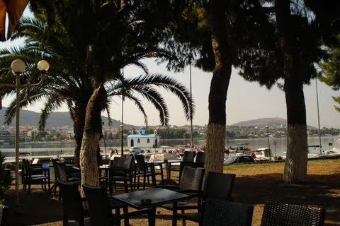
The first brief stop along the way was the town of Hope. (The sign itself captured my attention!) Hope is the entryway to the Fraser Canyon where the mighty Fraser and Coquihalla rivers join. The town is nestled in the mountain pass of the Cascade and Coast Mountains.

Heading north, we soon pass the famous "Hells Gate", located immediately downstream of Boston Bar in the Fraser Canyon. Here the towering rock faces of the Fraser River plunge toward each other creating rapids.  From here you can go on river rafting excursion through this narrow passage of roiling water.


This has also been a popular fishing ground for the local aboriginal communities and in the past, European settlers also congregated there to fish for salmon.  It was on this route that the gold rush miners traversed up the river to the Cariboo gold fields.

This is also the canyon area where the first explorers came paddling down the river or portaging to the Coast. The scenery is spectacular, still as wild as it was then when later men trudged north in search of gold.

North, toward the village of Cache Creek, there were the remains of forest fires that had ravaged the countryside in recent years.

Cache Creek is located at the junction of the Trans Canada Highway and Highway 97 on the Thompson Plateau, junction of the Cariboo and Thompson Valleys. There are rolling grasslands and hills covered in sagebrush and cactus with a backdrop of beautiful mountains.


Cache Creek was the halfway point for prospectors en route to the Cariboo Gold Fields. Here (above) you'll see a way-marker pointing in the directions of the many places these hopeful miners came from. Many were from California, others from England, Scotland, Ireland and other European countries.  Today travelers like myself who are following the historical gold rush trail still stop off at Cache Creek.

All along the route are pristine lakes.  The little town of Lac La Hache is renowned for excellent fishing. The lake is a popular for swimming, boating, parasailing, water skiing and camping. Even in the winter there are activities such as ice fishing, cross country skiing and skating.  I was most impressed by Lac La Hache. For many years I knew the name but this was the first time I'd visited there.

 
Next stop is the rustic village of 100 Mile (also known as "Hundred Mile House") located on a plateau where there are numerous lakes.  The area is excellent for swimming, fishing, bird watching and horse-back riding. For thousands of years the Chilcotin First Nations lived, hunted and traded here and still claim the region as their traditional territory. In the mid 1800's miners flocked to the area folling the news of gold in the Cariboo. A wagon road was built to manage the traffic that came up from Lilloet on the Fraser River north to Barkerville. At the time, this was known as Bridge Creek House and was renamed 100 Mile House because it was 100 miles from Lilloet (Mile 0). Between 1862 and 1870 there were more than 100,000 travelers through this region. Eventually a freight and stagecoach line carried people and provision to the gold fields, cattle were imported and a thriving ranching culture developed.  By the 1900's logging and forestry became the dominant economic source.  Today tourism, logging and ranching are the leading industries in the South Cariboo.

After Lac la Hache, passing through 100 Mile, there is another spectacular lake known as Dragon Lake.  At the north end of this lake is Williams Lake, a small town in the central Cariboo. They are famous for the Williams Lake Stampeded. The town is named in honour of Secwepemc chief William who was instrumental in counselling the Shuswap band from joining the Chilcotin in their uprising against the new settlers back in the 1860's during the Cariboo Gold Rush.

This entire area is so rich with history, that for a history-buff like me it was a treasure trove of stories, added to the magnificent scenery.  It was easy to imagine being one of those early settlers, the men trudging north to the gold fields, or the brave explorers who came down the river to the west coast.

The Cariboo Gold Rush attracted a rush of American prospectors to the Fraser Canyon in 1858 Many stayed on as permanent settlers. Others began to explore the rest of the province searching for new finds. It was after Billy Barker, a miner from England, struck pay-dirt north in Barkerville, that floods of men arrived from other parts of the world seeking their fortune in the gold fields around Quesnel.  The area became known as "the Cariboo", NOT "Caribou", which is an Algonquin word "xalibu" meaning "a pawer or scracher'. In BC it is regarded as a corruption of the French word "Cariboeu or Cerboeuf" meaning "reindeer" as it is a favorite haunt of that species.

After ten enjoyable hours on the Greyhound bus, by 6.30 pm that evening I arrived at the town of Quesnel where the next phase of my Cariboo adventure began.

NEXT: Part II.  Quesnel and beyond.


Monday, July 13, 2009

RETURN TO OLD SARUM

FORTIFICATION DITCH, OLD SARUM

May 28, after leaving Bath by train we arrived at Salisbury. Our intention (even before visiting Bath) was to head for the Iron Age hillfort at Old Sarum. We didn't regret our unexpected side-trip to Bath, however, and lingered there quite awhile before taking the train to our next destination. We got the hop-on-hop-off bus from the Salisbury station and set off for Old Sarum.

FORTRESS RUIN

This part of the trip, for me, was a renewal of some research for my W.I.P. novel "Dragons in the Sky: A Celtic Tale". As soon as I complete work on "Shadow of the Lion" I want to return to this beautiful first-person narrative that I'd set aside years ago in order to work on Alexander's story.

DRAGONS has a magic quality to it -- right from the beginning when I was searching for a setting for this story that was told to me by a Celtic girl, Olwen, in a voice that was almost as if I was channeling her. (Or maybe she was me in another lifetime.) I had gone to visit a friend in Bournemouth and then on to Stonehenge and later, while waiting in the bus station at Salisbury I'd noticed a sign that said "Old Sarum Iron Age Hillfort, 4 kms". I decided to walk there.

As I approached the earth mound where this ancient fort has once stood I had one of those dejas-vu moments where I actually could 'see' it all unfold as if I had actually been there before.
This, I knew, was the setting of my story about Olwen, the Druid's child.

I've made a couple of trips back to Old Sarum and made lots of notes, impressions, etc. But it's been some years now and I needed to refresh my mind and see if I could pick up any new 'vibes' at the site.

The times before I'd been alone, and this time I was with my sister and niece and as well there were other people on the hill. It was difficult for me to 'feel' anything, but I did take some video footage so I'd be able to refer to it later. I also discovered a part of the earth mound that I hadn't known was there on my first two visits. On top of the hill are the remains of the old fort.
This one would be at a much later date than Olwen's story, for DRAGONS is set in the 4th century B.C.

Old Sarum was developed in about 500 BC by Iron Age settlers and later occupied by Romans, Saxons and Normans. They built a castle and a royal palace and by the mid-12th century it was a busy town with a fine new cathedral Later a new settlement was made by the river, now known as Salisbury and Old Sarum was abandoned and fell into ruin.

After looking around and taking photos, we went back down to the road with the intention of hopping on the next bus to Stonehenge. Unfortunately we hopped on the wrong bus and then had to hop off and go back. No time for Stonehenge as we needed to get back to London to fetch our luggage and head for Cardiff.
VIEW OF SALISBURY FROM OLD SARUM MOUND


Add to Technorati Favorites
Posted by Picasa