Total Pageviews

Friday, September 21, 2012

THE NEW PORT MANN BRIDGE: A 'HISTORIC' CROSSING

The other day after lunch, my friend Renate asked me if I'd like to take a drive across the new Port Mann Bridge. It was opening day for the new bridge, kind of a 'historic' event, and a great opportunity to see the bridge close up and personal.  For months we've all watched the construction of this new bridge, adjacent to the old Port Mann steel tied arch bridge which opened in June 1964.


The new bridge is more than two kilometers long and has a 50 metre wide roadway surface.  There'll be 10 lanes when it's all completed by December.  It's one of the longest bridges in North America, as well as the widest. The bridge is supported by 288 cables, 23 piers, two abutments, 108 drilled shafts and 251 piles. The cables are attached to two pylon towers, each 160 metres high roughly the equivalent of a 50 story building. The towers stand approximately 75 metres above the deck level. Quite an impressive sight!


There were a lot of other drivers with the same idea but the traffic kept speeding ahead and we cruised across high above the mighty Fraser River, then turned around and drove back. The old bridge, alongside, looks so small in comparison!  And the new bridge, although it will be tolled, should open up a faster way for all the traffic that now clogs the highway from the suburbs into the city.


For today it was a freebie and a chance to try it out.  A historic moment for drivers and a really fun outing! 

Wednesday, September 19, 2012

MY CARIBOO ROAD TRIP: PART FOUR


ROLLICKING BARKERVILLE

It was the Cowboy and Drover Jubilee the weekend I visited Barkerville and the best way to describe it was ‘rollicking’. I felt the excitement from the  moment I walked through the entrance gate, where I was greeted by Dirk van Stralen the town’s marketing and communications director, and I was told, “Just let yourself pretend you are right back in the old days!” Dirk walked me part way down the dusty road of the town’s main street and explained some of what I might expect to see, then he bade be goodbye and I was on my own to explore.


It happened I was already at the wooden arch that marks Barkerville’s Chinatown so I continued on up the road, stopping to peek in windows and shops, visit the Lee Chong Co Store-Chinese Museum and watch a woman demonstrate how to play Chinese chess.

Chinese chess
 
Museum display of early Chinese pioneer

General store and Chinese Museum


Opium was legal until 1910.
 
 
Archaeological dig at site where the Chinese grew vegetable gardens


At the end of that road was a sign warning about bears, so I turned back. Another mile up the road is another village, Richfield, where the courthouse is located and you can watch a re-enactment of Judge Begbie, the “hanging judge” conduct a trial. If I’d had time I would have hopped on one of the stagecoaches and got a ride there. But there was just too much to see right in town so I headed back down the road to explore.

Barkerville is a typical gold rush boomtown. It was named after William (Billy Barker) who struck it rich in Williams Creek back in 1862. Billy was a prospector who had come from England to seek his fortune, leaving behind a wife and child. His wife eventually died in the poorhouse in England while Barker sought his fortune in the wild west of North America beginning with the California gold rush. Then he decided to come north. As luck would have it, his party discovered gold in the Williams Creek area. In a short period of time he and his crew pulled out about 60 ounces of gold and as a result, the settlement of Barkerville grew up around his claim. Barkers claim turned out to be the richest in the area. He pulled out roughly 37,500 oz. of gold during that time. But he died penniless in a Victoria nursing home on July 11, 1894 and was buried in an unmarked grave in the Ross Bay Cemetery.
William "Billy"Barker
 
Williams Creek
 
This year was the 150th anniversary of that famous gold find that started a stampede of adventurers and prospectors to the area converging on the gold fields.  Soon a settlement had built up with log cabins and shanties perched along the narrow muddy street. Merchants came there too, opening businesses of every description to provide for the miners and profit from their earnings. Women came too, including dancers called Hurdy-gurdy girls who came from Germany and Holland to perform in the saloons.


Blacksmith

Unfortunately six years later the town burned down. The story goes that a young miner was trying to steal a kiss from a Hurdy-gurdy girl in a bar and accidentally knocked over a lamp which set the place aflame. The town was quickly rebuilt but the glory days were waning and when another gold mine opened in nearby Wells in the 1930s some of the population moved there, although Barkerville was still occupied until 1958 when it became a heritage site.


Barkerville is one of the most intriguing and entertaining heritage sites I’ve visited in B.C. There are over 125 heritage buildings with rooms displayed in period furnishings just as if they are still occupied. A cast of actors including children, roam the streets and perform spontaneous dramas as would happen in daily life. As well there is the Royal Theatre that presents a rousing vaudeville show. There’s also demonstration of some of the mining equipment such as the Cornish Wheel that is sure to amuse with a feisty prospector and an ever-so-proper British lady, daughter of the mine owner.
The prospector and the lady demonstration the Cornish Wheel
 
The Royal Theatre
 
Cast of the Royal Theatre
 
 
Women's fashions
 
Street scene
 
 
Horse-drawn stagecoaches, wagons and buggies trot up and down the street and will take you on to the next town to the Richfield Courthouse where Judge Begbie presides over a trial.  


I spent the entire day wandering and still couldn’t possibly see everything. I missed my chance to attend a school room session, and forgot to visit the cemetery. There was just so much to see I missed the Cowboy poets but I did attend a performance of the four finalists for the cowboy singing contest held in the old Methodist Church.
Prospector's cabin
 
Dentist's office
 
Had I realized just what a rich experience this was going to be, I’d have booked into one of the B&Bs right on site and stayed an extra day giving me a chance to experience Barkerville by night.  That’s definitely on my ‘to-do’ list next time I visit the Cariboo!

Barkerville B&B


To get there if you don’t have your own transportation, I booked with West Coast Nature tours which included my hotel and transportation by shuttle to and from Quesnel.


Accomodation is available at the two B&Bs on site at Barkerville, at nearby Wells, or Quesnel as well as various campsites in the area.
Barkerville is open year-round. Summer programs take place May to late Septemb

Saturday, September 15, 2012

MY CARIBOO ROAD TRIP: PART 3

WHERE IN THE WORLD IS WELLS?

I have heard of the town called "Wells" for many years and always wondered where it was and who lived there.  On my road trip to Barkerville, after the shuttle driver picked me up at Quesnel that Saturday morning, he said we would be making a brief stop at Wells to pick up other passengers. I would finally have an opportunity to see just where in the world Wells was and what this tiny town nestled 1200 meters up in the mountains had that might attract people to live there.


Back in the 1930's Wells was a company townsite for the Cariboo Gold Quartz Mine.  Its close proximity to the gold rush town of Barkerville made it a stop-over place for travelers to the area. The town is unique with its wooden-framed heritage buildings that are painted bright colors. It has become a favorite residence for writers and artists and is the home of the Island Mountain Arts School and Public Gallery. 


The narrow main street that looks like a set from a western movie is lined with coffee shops and art galleries.  The town has a theatre group that provides most of the actors for the interactive shows at Barkerville during the summer months, and there are various music events.  That weekend there was a Cowboy Jamboree dance in Wells, in conjunction with the Cowboy Jamboree weekend at Barkerville.


We only stopped long enough for me to take a few photographs but it piqued my interest enough that I wouldn't mind exploring it at another time.  There are hotels, motels, B&Bs and campground for travelers so it's a perfect stopping-off place for anyone going to Barkerville or other places in that area. 


The Williams Creek Nature Trail is near the town.  Wells has many well maintained hiking and biking trails and in winter opportunities for snowmobiling, cross-country skiing and dog sledding.  There are guided tours offered in the community and also equipment rentals.

I would have liked to explore more of this quaint little town but it was time to board the shuttle again and head farther up into the mountains to my destination: Barkerville, the town established and made famous during the Cariboo Gold Rush.

The road to Barkerville


NEXT: MY CARIBOO ROAD TRIP: PART FOUR:  The Rollicking Town of Barkerville

Friday, September 14, 2012

MY CARIBOO ROAD TRIP: Part 2

QUIET WALKS AROUND QUESNEL

After my 10 hour bus trip, I arrived in Quesnel at 6.30 pm and was pleased to find that my hotel was located just across the parking lot of the Greyhound station. I'd checked in to the Billy Barker Inn & Casino for two nights. 
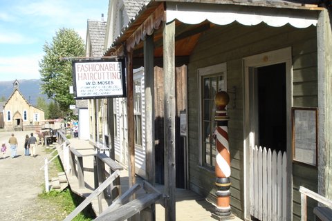
www.billybarkercasino.com  The very name of the hotel intrigued me and fit along with my planned adventure to Barkerville. William (Billy) Barker was the prospector famous for being one of the first to find a large amount of gold at Williams Creek where the town of Barkerville was established.


The hotel is built to look like the paddle wheelers that once plied the Fraser during the gold rush of the late 1800's. It's red smoke stack is visible from almost any corner of the town so once I went out exploring there wasn't much chance of getting 'lost'.  My pleasant little room was decorated in furnishings from the turn of the century really giving me a sense of being 'back in time'.


Quesnel is a pleasant little town, a perfect place to stop over if you are en route to Barkerville. From here I'll take a shuttle service into the old gold mining town.  If you don't have a car, the shuttle service is the only transportation into Barkerville.

My first venture was to walk about and explore the location and I was delighted to find that there are many options for exploring, something that came in very useful on my last day there when I had unfortunately missed my bus home and had to kill six hours browsing the town.

The town of Quesnel got it's name from Jule Maurice Quesnel who accompanied Simon Fraser (after whom the river is named) on his explorations down the Fraser River to the Pacific Ocean. It was originally known as Quesnellemouth to distinguish it from "Quesnel Forks" farther up the river, but by 1900 it was shortened to Quesnel.  As it was situated on the gold mining trail known as the Cariboo Wagon Road, it became the commercial centre of the Cariboo Gold Rush.  It is also the end of the Alexander Mackenzie Heritage Trail and was an important landing spot for the stern wheelers that plied the river.

Quesnel has a colorful history that includes the influence of the First Nations, pioneer explorers, Chinese immigration, gold rush fever and the fur trade. It's location at the confluence of the Fraser and Quesnel rivers has aided in the community's economic and cultural development. The entire area is rich in culture and history with various historical sites nearby.  The Chentsit'hala Carrier First Nations people met with Alexander Mackenzie when he traveled along the Fraser River in 1793 and in 1808, fur trader and explorer, Simon Fraser, camped at the junction of the rivers which today is the heart of Quesnel at what is now Ceal Tingley Park.  I was able to find these heritage sites as well as a number of heritage buildings while following the map of the Quesnel's Historical Heritage Walking Tour.
Across the river in this location known as the China Cut, is where the Chinese population settled. By the mid 1800's there was a sizable population of Chinese immigrants many of them prospectors seeking their fortune during the gold rush, others settling in Quesnel to become merchants and add to the town's economic and cultural growth.


Ceal Tingley Park, where you'll find the Quesnel Visitor's Bureau, is the site of Simon Fraser's camp.

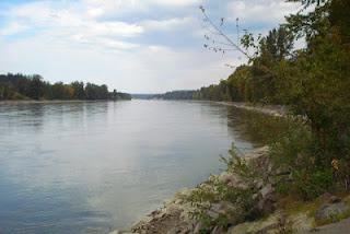
I took the walk along the heritage trail by the river. There are markers along the way pointing out interesting historical information and locations. The river trail is good for cyclists and joggers too, and I met friendly people along the way, stopping now and then to enjoy the view and the day's warm sunshine.

I noticed a lot of attractive wood carvings around the town. This one was at the start of the walk I took by the river.
Here is the old Fraser Bridge, now just used for pedestrians.  I walked across it the first evening I was there.


There are displays of old equipment located along the heritage walk.  These are at one of the entrances to the path.


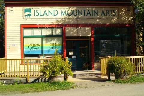
While browsing the town I also discovered several heritage buildings.  One of them was this church and the other was the Hudson Bay Company store.


There are many things to discover in Quesnel and even though I was upset for missing my bus on that last day there, I don't regret the opportunity it gave me to explore more of the town. I even found a perfect place to rest the last hour before finally catching the bus home.


NEXT: MY CARIBOO ROAD TRIP, part three:  WHERE IN THE WORLD IS WELLS?